It's starting to look like Southwest Louisiana is going to see quite a bit more rain before we reach the middle of the week. Anywhere from 1-3 inches is expected through Wednesday.
Well here we are only six days into the 2014 Hurricane season and we could be looking at our first storm. Wasn't this supposed to be a year when El Nino affected our weather and hindered hurricanes?
The disturbance that we watched cross the Yucatan Peninsula earlier this week has dissipated. Advisories have been discontinued. Tropical Storm Erin is expected to do the same in the middle of the Atlantic;but Mother Nature is brewing another.
What a difference a day can make in the life of a tropical weather system. Yesterday the forecast showed Dorian gaining strength as a tropical storm and closing in on Cuba by Wednesday. Today's forecast shows the system dying before it can even get that far.
You know how it works. Everyday we watch the storms path extended eastward. As the path is extended we learn more about the storms destination. The last extension on Dorian shows the storm could impact the gulf.
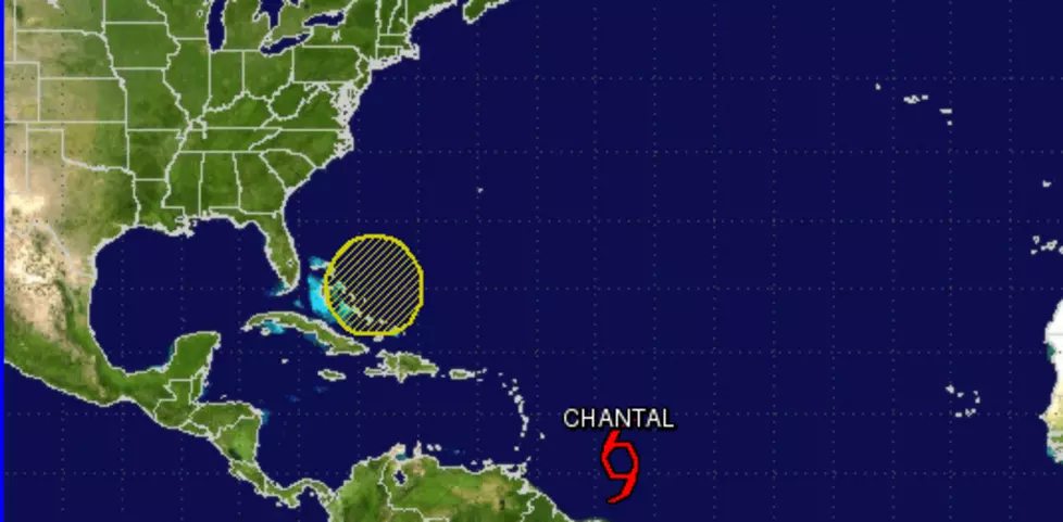
Tropical Storm Chantal has formed in the Atlantic north of the coast of French Guiana. At this time it looks like the storm could impact the Dominican Republic and Puerto Rico this week as a tropical storm. Then is heads in the general direction of Florida.
I hate the term "disturbed weather." Did someone wake this weather up from a nap or do something to make it mad? Regardless .... there is a weak low pressure system over the south-central Gulf of Mexico and forecasters are watching it for tropical formation.