Severe Weather Possible Friday Evening Into Saturday Morning
It's about time for the Springtime parade of cold fronts to begin their final marches across our state. This is the time of year when cold fronts still have enough strength to actually move through the area.
When Summer sets in and the Bermuda High sets up the strong southerly flow off the Gulf, cold fronts get bogged down before they make it through the state or they just go around.
Friday evening into early Saturday morning a strong cold front currently pushing out of the Rocky Mountains and across the Great Plains is expected to make its way into Louisiana.
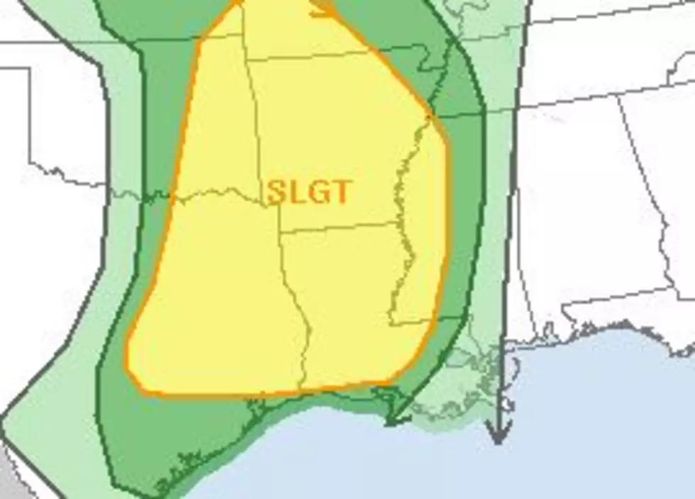
Forecasters with the Storm Prediction Center have forecast a slight possibility of severe storms and possible tornadoes. There is a strong possibility of heavy showers and storms regardless if they reach severe storm limits or not.
The good news is that most of the severe weather and rain should move through and out of the area while most of us are sleeping. There will likely be some residual rainfall leftover for early Saturday morning. After the system moves further to the east there will be some breaks in the clouds and late Saturday and Sunday look to be just fine weatherwise.
More From Gator 99.5


