How Bad and When? Timing Today’s Severe Weather in Louisiana
2:30 pm Update: A Severe Thunderstorm Warning remains in effect for the following areas until 3:30 pm: Northwestern Iberia Parish, Lafayette Parish, Vermilion Parish, St. Martin Parish, and Eastern St. Landry Parish. The storm is moving east at 20 mph with 60 mph wind gusts and quarter-sized hail being reported.
1:30 pm Update: A Severe Thunderstorm Warning remains in effect for the following areas until 2:30 pm: Iberia Parish, Southeastern Cameron Parish, Lafayette Parish, Northwestern St. Mary Parish, Southeastern Evangeline Parish, Acadia Parish, Vermilion Parish, Northwestern St. Martin Parish, and St. Landry parish. The storm is moving east at 45 mph with 60 mph wind gusts and quarter-sized hail being reported.
12:30 pm Update: Severe Thunderstorm Warning for the following areas until 1:30 pm: Eastern Cameron Parish, Central Lafayette Parish, Jeff Davis Parish, Southern Evangeline Parish, Acadia Parish, Southeastern Beauregard Parish, Eastern Calcasieu Parish, Vermilion Parish, Central St. Landry Parish, Allen Parish. Storm moving east at 60 mph with 70 mph wind gusts.
11:38 am Update: The National Weather Service has issued a Severe Thunderstorm Warning for the following parishes until 12:30 pm: Acadia, Allen, Beauregard, Calcasieu, Cameron, Jeff Davis, Southern Evangeline, Western St. Landry and Allen, Western Vermilion. Line of thunderstorms moving at 50 mph with 70 mph gusts.
7:55 am Update: The National Weather Service has issued a Tornado Watch until 4:00 pm for the following parishes: Acadia, Allen, Avoyelles, Beauregard, Calcasieu, Cameron, Evangeline, Grant, Iberia, Jeff Davis, Lafayette, Natchitoches, Rapides, Sabine, St. Landry, St. Martin, St. Mary, and Vermilion.
I guess the elephant in the room we need to address is the fact that no matter how much we want Mother Nature to handle her business on our timetable she is not going to do that. That being said, what we're about to tell you regarding when we can expect the worst of today's wild weather is basically an educated guess. That's why we are building some "wiggle room" into the timing.
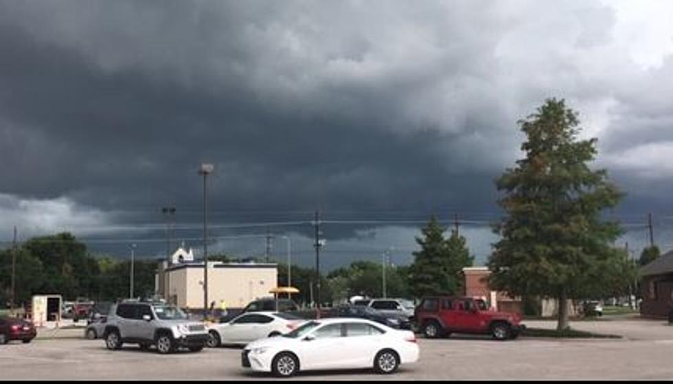
If you're not aware, most of Louisiana is under a threat of severe storms today. The better chance of stronger and severe storms is generally in the southern half of the state. This does include Lafayette, Lake Charles, Baton Rouge, and even New Orleans.
Early this morning showers and storms were firing up along a frontal boundary that extended from north of the Red River south through the Big Country region of Texas. That line of storms is expected to strengthen as it moves eastward during the early morning hours.

Forecasters with the Storm Prediction Center have placed much of our part of the state in the "slight risk" category for severe storms. However, the area from Lake Charles to Lafayette and Baton Rouge is now in the "enhanced risk" category. The SPC has this informative graphic that will help you better understand what that "risk" really means to you.

Model projections suggest the line of storms will push across the Sabine River into western sections of Louisiana around lunchtime today. Remember, the wiggle room, right? So that could be as early as 11 this morning or after 1 pm this afternoon.

Based on model guidance the stronger weather should push into the Lafayette area around 3 pm or so. This could pose some problems with picking kids up from school or meeting school busses so parents, be prepared should you need to move quickly to go and gather kids ahead of or during the worst of the weather.

As the storms push through your area you can anticipate strong gusty winds. Some of those wind gusts could cause damage. There will be some heavy downpours of rain and a lot of thunder and lightning. I wouldn't be surprised if a severe weather watch, such as a tornado or severe thunderstorm watch is issued. But as of this writing, none have been posted.
Once the line of storms moves through, conditions will improve quickly. However, temperatures will begin to fall rather quickly. Today's high is forecast to be in the upper 80s by early tomorrow our temperatures will be in the upper 50s. So, you can see the cooldown is coming and it will be ushered in by a gusty north wind too.
After the front has passed we can expect sunny but cool conditions for the rest of the week into the weekend. It should be quite nice for trick-or-treating events over the weekend. In fact, I think it will be a perfect night both Saturday and or Sunday depending on what day your community chooses to hold Halloween activities.
KEEP READING: Get answers to 51 of the most frequently asked weather questions...
More From Gator 99.5