Tropics Are Starting to Heat up With Another Disturbance
Over the weekend, South Texas dealt with Hurricane Hannah as it made landfall along the coast at Padre Island. Texas has been a hot spot for COVID-19, and residents had been dealing with that when they had to brace for impact from Hannah.
When the storm made landfall, it was a high-end Category One hurricane with winds at 90mph. Folks down in the area dealt with heavy rain, high winds, and flash flooding as Hannah moved in slowly onto the coast.
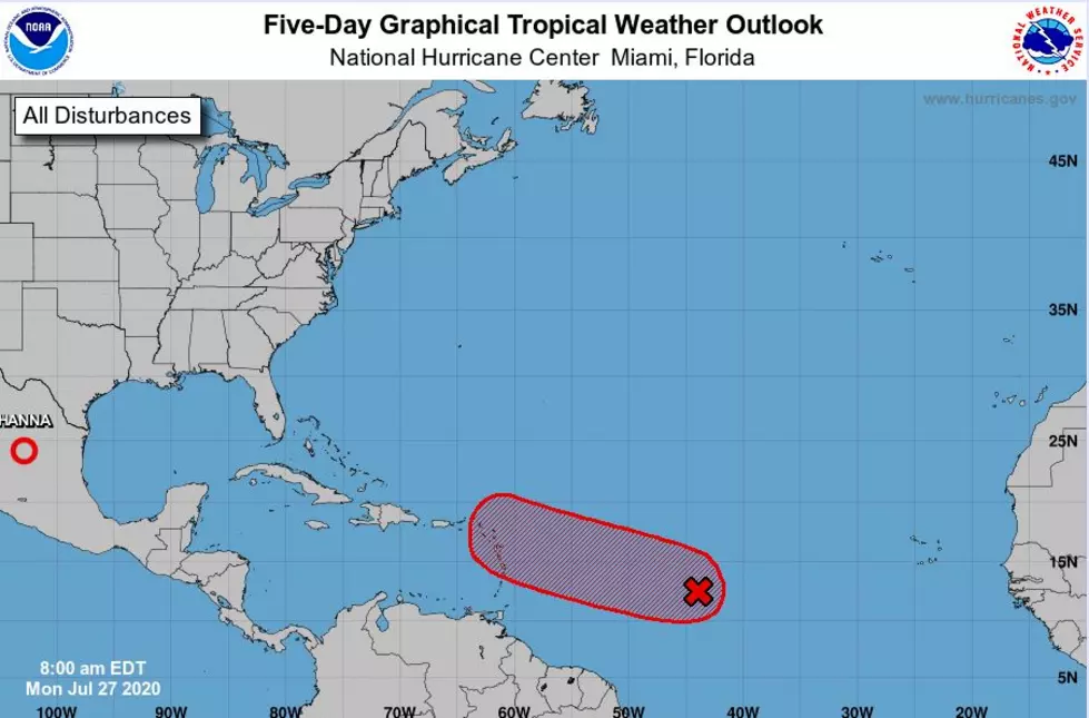
With the storm now inland, we would think okay, we are in the clear, but not so fast. There is another storm brewing in the Atlantic Ocean, and it has an 80% chance of formation in the next 48 hours and a 90% chance of formation over the next five days.
As of the 8:00am update, the National Weather Service is saying the system is forecast to continue moving Westward at 15 to 20mph and may start to affect the Lesser Antilles by Wednesday.
If and when this system forms into a Tropical Depression or Storm, it will be named Isaias. It will be the ninth named storm of the 2020 Atlantic Hurricane season if it does form like forecasters think it will.

Essential Cajun Survival Kit
More From Gator 99.5


